About D-Geo demo
This application allow you to manage points in any coordinate projection (all EPSG defined coordinate systems are supported). Points are painted on map. You can choose from online google maps, any WMS server or use...
This application allow you to manage points in any coordinate projection (all EPSG defined coordinate systems are supported). Points are painted on map. You can choose from online google maps, any WMS server or use offline solution based on Mapsforge maps (for example from http://www.openandromaps.org/ - please support this great project if you find them useful).
Application can also paint your own map. You can prepare data for android app thanks to PC application (you can download it for free from http://d-geo.pl). This application can import points from txt or xls files, import vector or raster data from many formats: Autocad (dxf, dwg), Microstation (dgn), ArcView shape (shp), Google Earth (kml), GML, GPX, MapInfo (mif, tab), geotiff and other. All imported files are combined into one dgeo project file used in android app. Map part are prepared as tiles – so this take a some time and some disk space (using only points produced small files). Since the v.0.94 map can be exported also as vectors. PC application can send your project file to android device (logged in the same wi-fi network). You can also put dgeo project file to Dropbox or copy directly to D-GEO directory on SD card.
Point from points list can be easy locate on map by long tap on them. You can add points by tap on map or writing their coordinates.
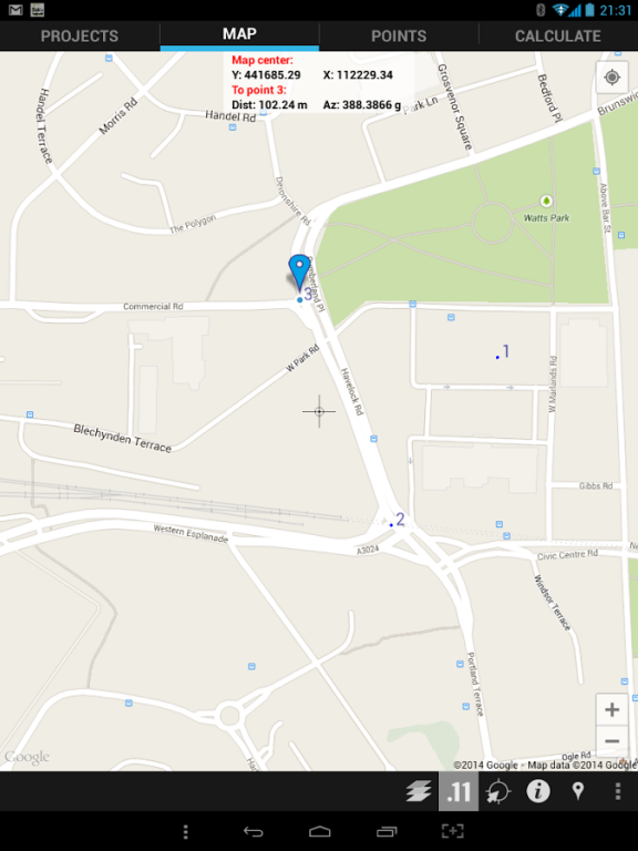
Info panel on map can show your position and distance/azimuth to selected point (all coordinates are presented in project specified projection).
Points can be:
- add, edit, delete
- shared to other applications as position, navigation and street view,
- exported and imported from/to txt files
App have built simple calculations:
- azimuth, distance between two points
- lines intersection (lines defined by two points each)
- point reprojection from any coordinate system to actually used
- angle from coordinates
- linear intersection
- angular intersection
- 3 point resection
Tags: GIS, geodesy, survey, land surveying, surveyor
Previous Versions
Here you can find the changelog of D-Geo demo since it was posted on our website on 2016-10-08 17:59:51.
The latest version is 0.95 and it was updated on 2024-04-19 22:15:14. See below the changes in each version.
D-Geo demo version 0.95
Updated At: 2015-03-10
Changes: Fixed problems with Android 5.0.1 devices
Disclaimer
External Download
We do not host D-Geo demo on our servers. We did not scan it for viruses, adware, spyware or other type of malware. This app is hosted by Galad and passed their terms and conditions to be listed there. We recommend caution when installing it.
The APK Download link for D-Geo demo is provided to you by apps112.com without any warranties, representations or guarantees of any kind, so access it at your own risk.
If you have questions regarding this particular app contact the publisher directly. For questions about the functionalities of apps112.com contact us.